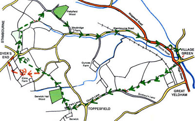
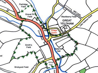
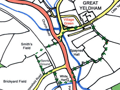
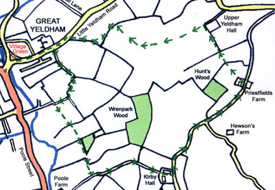
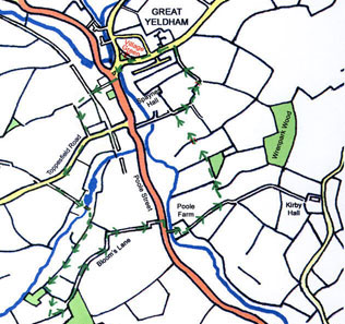
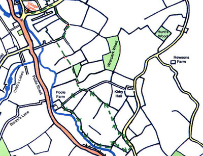
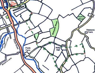
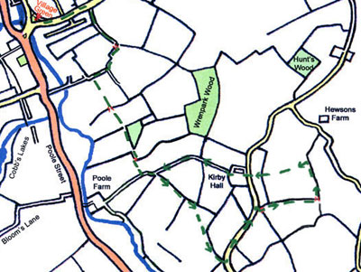
Walk 1 clockwise. 7 miles

Walk 1 anti-clockwise. 7 miles
Contact: Mark Wood, tel: 01787 237593, or e-mail mark@markwoodwheels.co.uk for more information.
Walk 1 clockwise. 7 miles
Walk 1 anti-clockwise. 7 miles
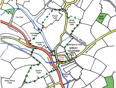
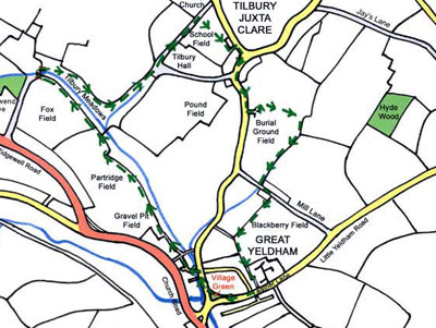
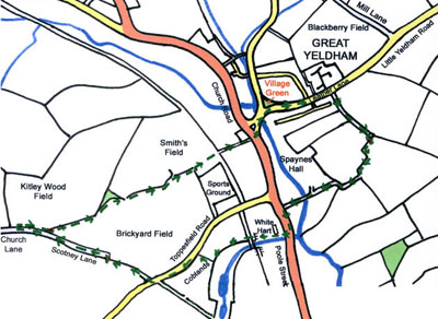
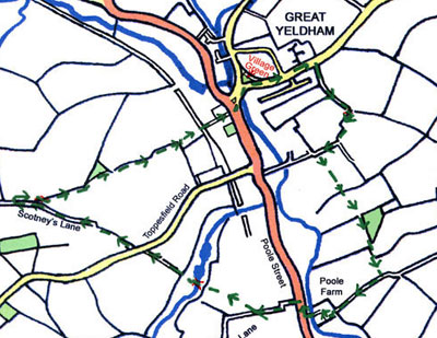
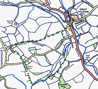
Walk 2 clockwise. 4¼ miles
Walk 2 anti-clockwise. 4¼ miles
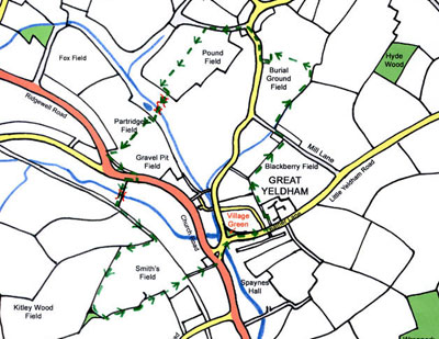
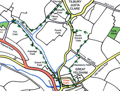
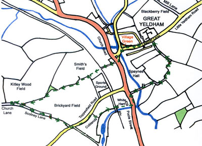
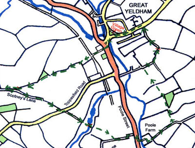
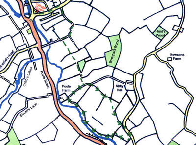
Walk 3 clockwise. 4¼ miles
Walk 3 anti-clockwise. 4¼ miles
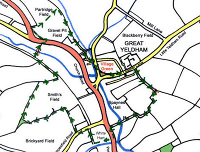
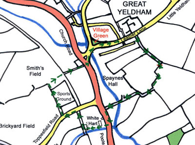
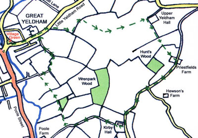
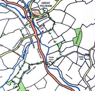
Walk 4 clockwise. 4 miles
Walk 4 anti-clockwise. 4 miles
Walk 5 clockwise. 2 miles
Walk 5 anti-clockwise. 2 miles
Walk 6 clockwise. 3½ miles
Walk 6 anti-clockwise. 3½ miles
Walk 7 clockwise. 4½ miles
Walk 7 anti-clockwise. 4½ miles
Walk 8 clockwise. 4¼ miles
Walk 8 anti-clockwise. 4¼ miles
Walk 9 clockwise. 4½ miles
Walk 9 anti-clockwise. 4½ miles
Walk 10 clockwise. 4¾ miles
Walk 10 anti-clockwise. 4¾ miles
Walk 11 clockwise. 4½ miles
Walk 11 anti-clockwise. 4½ miles
Walk 12 clockwise. 4¾ miles
Walk 12 anti-clockwise. 4¾ miles
30 Apr 2013